

Santo Antão: one of the most beautiful places I’ve ever been. Also one of the most physically demanding. Walking up and down the trails for hours every day left my legs alternating between frozen tight and floppy as a puppy’s.
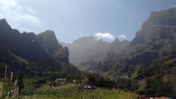
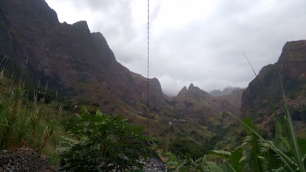
The photo above is the view from the guesthouse where I stayed in Paul, the greenest of the ribieras / valleys / canyons on the island. I didn’t realize when I booked the place, but you have to hike twenty minutes up a very steep trail to get there. They have porters who carry your bag for you, on their heads, while wearing flipflops, and they get to the top in half the time you do.
As soon as I had dropped my bag, or rather, as soon as my bag was dropped for me, I headed back out to try to hike as much of Paul as I could before dark. At every turn, there was something jaw-dropping to take in. (Which was convenient, because at every turn you also had to stop and catch your breath.)
Photos do not do this place justice, nor does video, but it comes a little closer…
Here’s the first lookout point that blew me away:
I continued on for another 2 or 3 hours from there, until my legs were about to give out and I realized I needed to turn around to get back before dark. (Navigating these paths after nightfall is an impossibility – or at least a very dumb idea – unless you’re a local.)
Speaking of locals… I was huffing and puffing my way up a crazy winding incline when I spotted these two ladies ahead of me, casually chatting and slowly but seemingly effortlessly making their way up the same hill I was having so much trouble with. (It may not look that steep here, but note the place where you can’t see the path any longer. That’s because it descends at like a 45 degree angle from there.) It turns out the woman on the left is the women on the right’s mother. An old lady carrying a bag on her head was in laughably better shape than me. I don’t feel that bad about it because I’m not actually in bad shape. Rather, the people of Santa Antão are in superhuman shape from a lifetime of climbing up and down hills in flimsy shoes while balancing stuff on their heads.

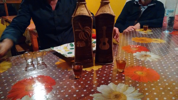
That night, there was a communal dinner in the guesthouse, after which the owner broke out the grogue (the national drink, a kind of rum) and ponche (grogue sweetened with molasses). I slept very well that night…
…and the next morning I got up really early to glom on to a 15-kilometer oceanside hike that an English couple had invited me to do with them. We stopped a few times along the way for incredible photo opps. This is Ribiera Grande.

Here’s the video I took right around there:
We started the six-hour hike at Cruzinha and our destination was nearly 9 miles away, at Ponta do Sol. You can see it in the distance in the shot below. The trail was not difficult in terms of clambering or climbing; the tough part was that you were constantly going steeply uphill or steeply downhill around crazy switchbacks. But the payoff, as in Paul, was that around each turn lay another spectacular view.

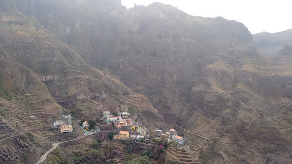
Here’s the town of Fontainhas, nestled into the curve of the mountains with the sea just beyond.
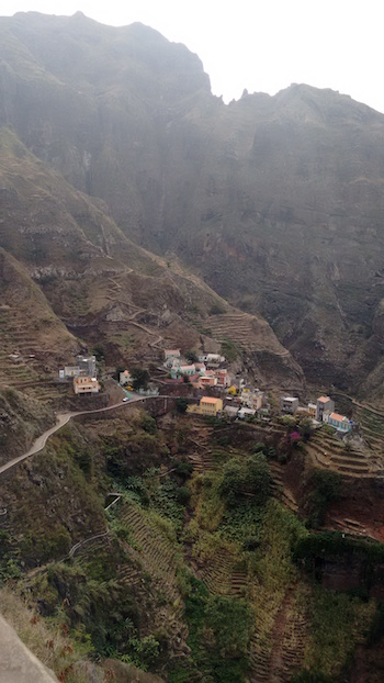
It’s impossible for any one picture to do justice to this town. You have to look at like twenty of them from all different angles to see why it is so incredible.
We had started out so early that I made it back to Paul by 3pm or so. Because Paul was the canyon I wanted to see most and because I had not had the chance to see all of it the day before, I decided to climb up the other side of the canyon as far as I could before dark. I wouldn’t call that a mistake per se. I’ll just say that my legs revolted and started freezing in midair with every step, until I started worrying that I might topple over and tumble back down the hill if I couldn’t get my foot to make landfall.
When I turned a bend and got to this spectacular view I decided to call it quits. Though calling it quits meant I still had to get back down to the main road and then climb back up twenty minutes to the guesthouse.
So when the owner announced at dinner that night that she had organized an optional excursion by van for the next (and my last) day, I jumped at the chance. (But only figuratively, because I could no longer move my legs.)
Again, amazing views at every turn.

Here’s a video of the views from near the aptly named town of Xoxo (pronounced Shosho):
It’s hard to appreciate the full beauty of this place in images, because of the combination of haze and brightness. In person, it was more than magnificent.
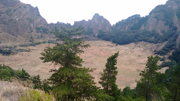
One of our last stops was a crater that was formed by a volcano collapsing in on itself.
From the crater, we headed back across the island to the ferry. The wind gusts were so strong at the port that they nearly knocked me over, and the ferry was tipping back and forth like a scene from a storm-at-sea movie. I was very happy to get back to shore in Mindelo, though not at all happy to get back to wi-fi. Catching up on the news from home before officially ending my vacation was ill-advised.
My advice to others thinking about Santo Antão is thus three-fold: You need at least four or five days (and ideally six or seven) to explore the island, not the three and a half I had. If you’re looking for green, go in December or January, right after the rainy season ends. And to avoid re-entry trauma, try to stay off the Internet for two or three days after you leave, to help ease your passage from paradise back to reality.
